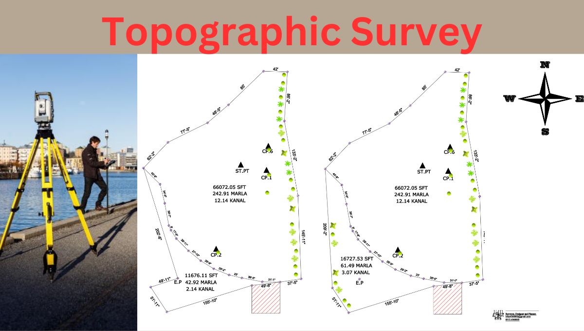
Conducting a Topographic Survey means to measure the land using total station. A total station is an electronic tool used in topographic and land surveying. The instrument station combines a horizontal and vertical angle-measuring electronic theodolite with a precise distance-measuring electronic distance measuring equipment (E.D.M).
Here we will discuss how to conduct a topographic Survey using Total station.
Conducting Topographic Survey using Total Station
Here are some steps during conducting a Topographic Survey.
1. Set up the Total Station.
Place the total station on a steady tripod on flat ground.
Adjust the instrument for accurate readings. Adjusting means centering leveling and focusing the instrument.
2. Mark Control Points.
Put markers in key spots around the area you’re surveying. Search control points already given in the Surveying area. if you don’t find it, make at least two control points that’s also called Bench Marks. (BM)
3. Attach the Prism.
Attach Prism on the rod. Use that prism to demarcate the boundaries and BM. Fix a reflective prism on the exact point you want to measure.
4. Take Measurements.
Use the total station to measure angles, distances, and heights to the prism.
5. Record the Data.
Write down the measurements carefully, including point numbers and other details. you can also save your data in total station by using record option.
6. Move to the Next Spot.
If the Surveying area is large and you can not cover the measurement on one place. Shift the total station to the next location with a clear view of the prism.
7. Repeat the Measurements.
Take measurements for all the points you’re interested in, moving the total station as needed.
8. Process the Data.
Transfer the recorded data to a computer. Use software to calculate coordinates and elevations, creating a detailed map. you can use software to make drawing like auto CAD civil 3d.
9. Check for Accuracy.
Double-check the survey’s accuracy by comparing it with control points or using additional measurements.
10. Create Reports and Maps.
Make reports and maps based on the processed data for clear presentation.
Conclusion
A total station is a powerful electronic tool that is commonly used in topographic and land surveying. In order to calculate angles accurately, it combines the abilities of an electronic theodolite and an electronic distance measurement tool (E.D.M).
With the precision and effectiveness of land surveying substantially improved by this technology, it has become a magical instrument for creating accurate topographic maps and assisting several land development projects.