KOLIDA is a Chinese surveying equipment company founded in 1989. They started as a small store in Guangzhou and quickly gained popularity among surveyors and engineers. They became a distributor of Japanese brands and developed their calculator and program for total stations.
The instrument introduced innovative products like distance meters and theodolites. They later pioneered the production of 100% made-in-China total stations, becoming a well-known brand.
In 2005, KOLIDA expanded internationally and now offers a wide range of surveying instruments and technology. They have manufacturing sites in different cities and maintain control over the production process. KOLIDA has a global distribution network with stores, e-commerce, and service centers.
Kolida Products
KOLIDA offers a diverse range of products in the field of surveying and mapping. Their product portfolio includes:
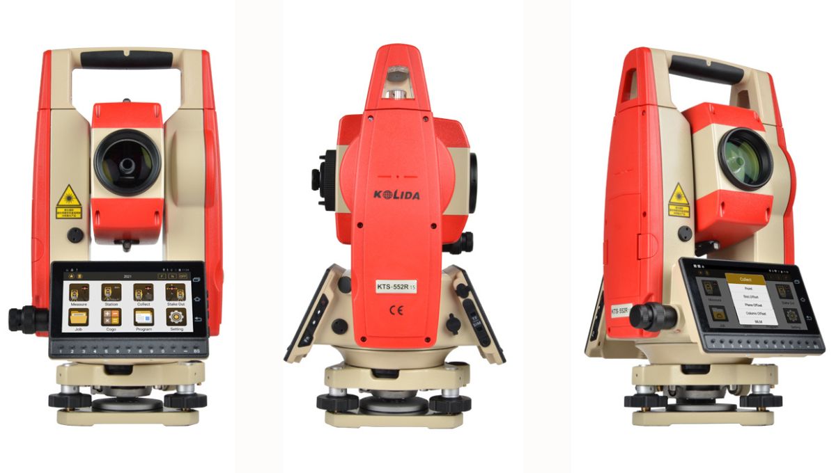
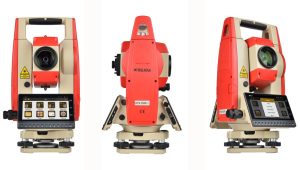
1. Total Stations.
KOLIDA manufactures total stations, which are precision optical instruments used in surveying and construction. These total stations are equipped with advanced features such as electronic distance measurement (E.D.M), angle measurement, data storage, and various surveying functions.
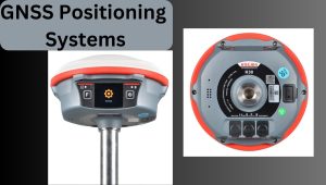
2. GNSS Positioning Systems.
KOLIDA develops Global Navigation Satellite System (GNSS) positioning systems. These systems utilize satellite signals to determine precise positioning coordinates for surveying, mapping, and navigation purposes. KOLIDA’s GNSS systems offer high accuracy and reliability.
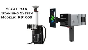
3. LIDAR Technology.
KOLIDA specializes in Light Detection and Ranging (LIDAR) technology. KOLIDA’s LIDAR technology finds applications in land surveying, forestry, urban planning, and more.
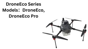
4. UAV Photogrammetry.
KOLIDA incorporates Unmanned Aerial Vehicles (UAVs) and photogrammetry technology in its product lineup. UAVs equipped with cameras capture aerial images, which are then processed to create accurate topographic maps, 3D models, and orthophotos. This technology is widely used in surveying, mapping, and land management.
5. Software Solutions.
KOLIDA develops software solutions that complement its hardware products. These software applications aid in data collection, processing, analysis, and visualization for efficient surveying and mapping workflows. They provide user-friendly interfaces and advanced tools for data management and interpretation.
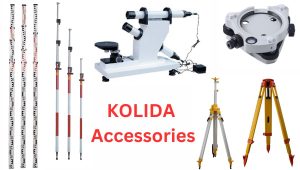
6. Accessories:
KOLIDA offers a range of surveying accessories, including tripods, prisms, poles, adapters, and other related equipment. These accessories are designed to enhance the functionality and compatibility of their surveying instruments, providing users with comprehensive solutions.
Moreover, KOLIDA focuses on innovation, precision, and quality in its product offerings, aiming to meet the diverse needs of surveyors, engineers, and professionals in the Geo spatial industry.
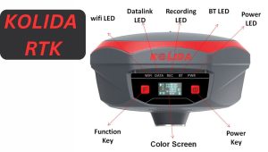
KOLIDA RTK System
KOLIDA’s Real-Time Kinematic (RTK) system is a high-precision positioning solution designed for surveying and mapping applications that require real-time, centimeter-level accuracy. RTK technology allows for precise positioning by utilizing a base station and one or more roving receivers.
Here are some key features and components of KOLIDA’s RTK system:
1. Base Station.
The RTK system includes a base station that receives signals from multiple GNSS satellites. The base station accurately calculates its own position and then transmits correction data to the roving receivers.
2. Roving Receivers.
The roving receivers, also known as mobile units, are carried by surveyors or mounted on surveying equipment. They receive the correction data from the base station, which helps improve their positioning accuracy.
3. GNSS Technology.
KOLIDA’s RTK system utilizes advanced GNSS technology, such as GPS (Global Positioning System) and other satellite constellations like GLONASS, Galileo, and BeiDou. These systems provide a wide range of satellite signals for robust positioning and increased availability.
4. Real-Time Accuracy.
The RTK system achieves real-time, centimeter-level accuracy by applying the correction data received from the base station to the measurements made by the roving receivers. This high precision enables surveyors to perform detailed mapping, construction layout, and other applications that demand precise positioning.
5. Data Communication.
The base station and roving receivers communicate with each other through a wireless data link. This enables real-time transmission of correction data, allowing the roving receivers to continuously update their positions with high accuracy.
6. Software Integration.
KOLIDA’s RTK system is typically used in conjunction with surveying software that facilitates data collection, processing, and analysis. The system integrates seamlessly with the software, providing a comprehensive solution for surveyors to efficiently conduct their fieldwork.
KOLIDA’s RTK system offers surveyors and professionals in the Geo spatial industry a reliable and efficient solution for high-precision positioning. With its real-time accuracy and integration capabilities, the RTK system helps streamline surveying workflows and improve overall productivity in various applications such as land surveying, construction, infrastructure development, and more.