In this article, we will discuss the Surveying codes that are commonly used. Land surveyors use standardized codes to communicate information about the features being surveyed, such as boundaries, contours, and elevation benchmarks.
These codes allow for accurate data recording in the field, which can then be translated into detailed maps and plans for a variety of applications. These are essential in land surveying and enable effective communication between surveyors.
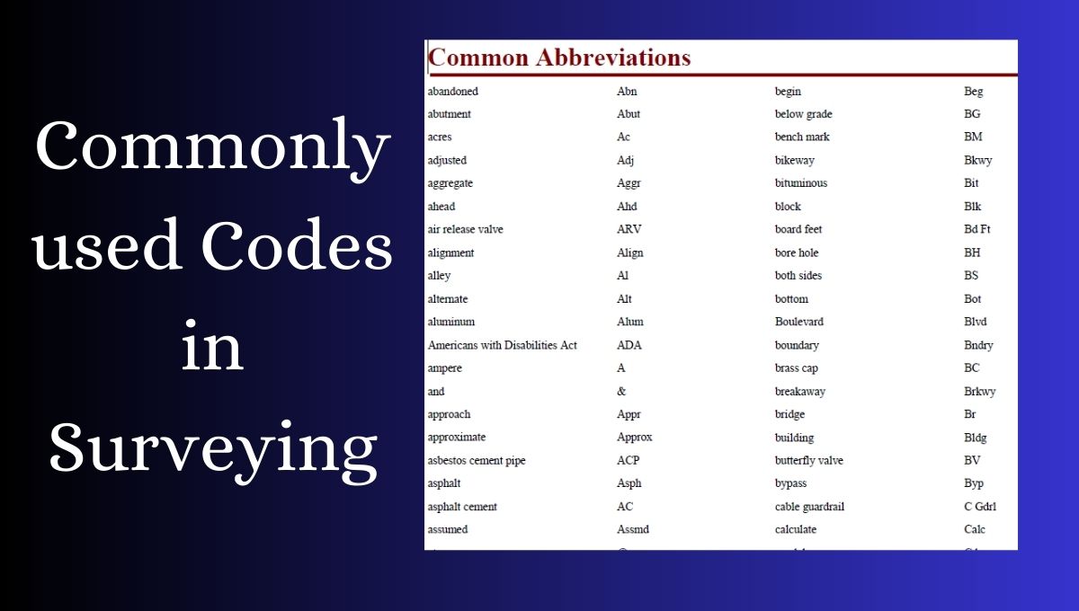
Surveying Codes
The codes, often called survey or field codes, are shorthand notations used by surveyors to describe features, measurements, and field observations. They provide a common language for surveyors, making data recording more concise and uniform.
While doing a survey on any project, the codes you are inserting in the total station should be simple and straight, so that they will be easy to understand for your CAD operator, architect, or any other person while creating the drawings.
Advantages of Using Surveying Codes
Using surveying codes offers several advantages:
Efficiency.
Surveyors can record data faster with codes, saving time compared to writing detailed notes by hand. This speeds up fieldwork.
Consistency.
Standardized codes make sure that everyone on the team uses the same words for data collection. This avoids confusion.
Accuracy.
Codes lower the chances of mistakes when transferring field notes to digital records or maps. This means the information stays correct.
Downloads
You can download the codes here.