In this article, we will discuss traversing. Before traversing we need to know about traverse. A traverse is an uneven Geometrical shape that has more than four sides. if we have a geometrical shape and have three sides, we call it a triangle.
If we have four sides so we call it a square or rectangle. If we have more than 4 sides then it’s called hexagon, heptagon, octagon, and so on.
But in the traverse, if the sides of the shape are used as survey lines, we call it Traverse in Surveying.
What is Traverse?
A traverse in surveying is a connected series of lines used to measure distances and angles. It helps determine the shape and size of an area. Traverses are important for establishing boundaries and obtaining measurements for calculations like area and angles.
Traversing in Surveying
Traversing in surveying is a technique to determine the positions of survey points by measuring the angles and distances between them. It involves creating a closed loop of connected survey lines to map out the boundaries and shape of an area. Traversing helps calculate area, angles, and distances accurately. Surveyors use this method to obtain precise representations of surveyed areas.
Types Of Traverse
There are two main types of traverse in surveying.
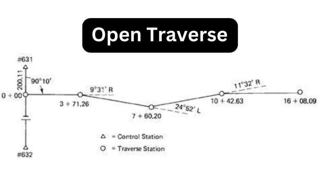
1. Open Traverse
This type of traverse has there starting point and ending point of different places. This type of traverse is used for road Surveying, railway lines surveying, canal surveying, Pipeline, and Transmission Line Survey.
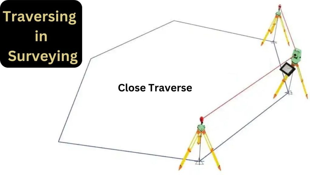
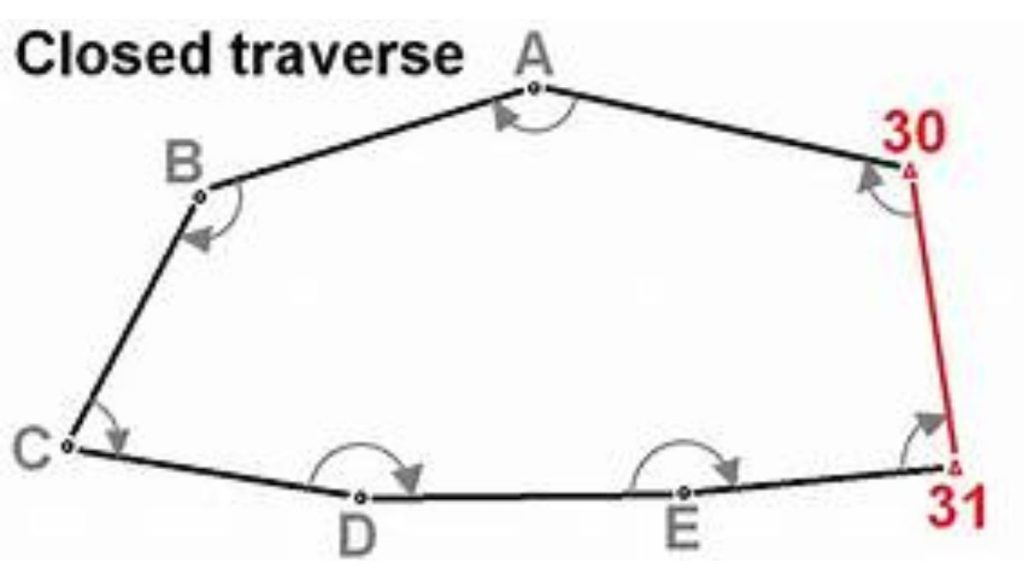
2. Close Traverse
Close traverse has its start point and end point in the same place. This type of traverse is used for the calculation of the area of land, topographic surveying, and contouring purposes.
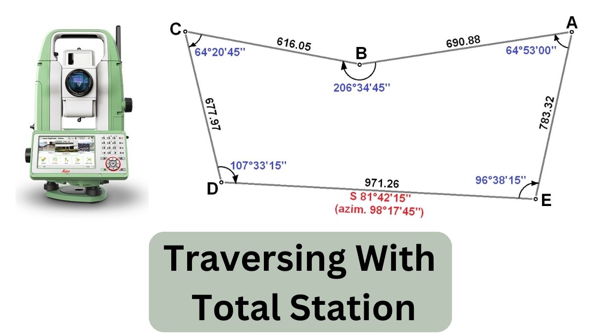
Traversing with Total Station
Traversing with a total station combines the traditional traversing technique in surveying with the advanced capabilities of a total station instrument. The total station is a new and modern technology to perform surveying. The total station is an electronic device that integrates a theodolite for measuring angles and a distance-measuring instrument.
When using a total station for traversing, the process typically involves the following steps:
1. Setup
Set up the total station at a known reference point and ensure it is level and properly calibrated.
2. Back sighting
Measure the angles and distances from the reference point to the first survey point. This is called back sighting and serves as a control for subsequent measurements.
3. Occupying new points
Move the total station to each subsequent survey point while measuring the angles and distances from both the backsight point and the new setup point.
4. Traverse calculations
Use the measured angles and distances to calculate the coordinates and positions of each survey point relative to the reference point. This involves applying trigonometric calculations and surveying software.
5. Data collection and adjustments
Collect and record the measured data accurately. Apply necessary adjustments, such as correcting for instrument errors or compensating for atmospheric conditions, to ensure precise results.
6. Closure and error analysis
Check for closure errors by comparing the final survey point back to the reference point. Analyze any discrepancies and apply appropriate error distribution or correction techniques.
7. Data processing
Process the collected data using surveying software to generate accurate coordinates, distances, and angles for the traversed points.
8. Accurate working capability
Using a total station for traversing offers several advantages, including faster data collection, increased accuracy, and the ability to store and process measurements digitally. It streamlines the surveying process and allows for efficient calculations and analysis of the surveyed area.
Manual Traversing with Total Station
To perform manual traversing using total station is to find out the basic method that how total station measures distance and angle and makes bearings from one angle and the previous bearing. We can also find out the formulas to calculate bearing and coordinates.
CONCLUSION
In conclusion, traversing with a total station combines traditional surveying techniques with the advanced capabilities of a total station instrument. It offers faster data collection, increased accuracy, and efficient processing of measurements. By following the steps of setup, back sighting, occupying new points, traverse calculations, data collection and adjustments, closure and error analysis, and data processing, surveyors can obtain precise coordinates, distances, and angles for the surveyed points.
Traversing with a total station is a valuable method in surveying that enhances productivity and ensures reliable results for mapping and analysis purposes.